

 Tiếng Việt
TRAINING INFORMATION
Program Name: Surveying Engineering Technology
Program Code: 6510902
Qualification: College Diploma
Mode of Study: Full-time
Admission Method: Admission by application review
Admission Requirements: High school graduates or equivalent
Faculty: Faculty of Bridge and Road Construction
Program Description
Surveying Engineering Technology plays a very important role in the overall development of the construction industry, including applications in surveying, cadastral mapping, remote sensing, satellite positioning, and geographic information systems.
Surveying Engineering Technology is a program that equips students with knowledge and skills to perform tasks in design and construction organization for positioning works using modern satellite technologies, topographic and cadastral mapping projects, operation of geographic information systems, and total station surveying methods serving construction activities.
Working Competencies
+ Ability to prepare topographic and cadastral maps;
+ Ability to set out high-rise building projects;
+ Ability to conduct topographic surveys using satellite technology and determine positions of geographic features;
+ Ability to create maps from aerial photographs using supporting equipment such as aircraft;
+ Ability to perform surveying, mapping, land administration, and natural resource management tasks;
+ Ability to survey and prepare topographic and cadastral maps for civil purposes;
+ Ability to conduct site surveys, construction layout measurements, engineering design support, deformation monitoring, and construction supervision;
+ Ability to perform survey and construction activities;
+ Ability to prepare topographic and cadastral maps serving construction and land management purposes;
+ Ability to analyze, forecast, evaluate, summarize, develop programs, and propose solutions related to the profession;
+ Ability to collect data, develop strategies, prepare plans, and investment projects;
+ Ability to draft and implement policies related to minerals and natural resources management.
Job Positions
After graduation, students are qualified to work in positions such as:
+ Government officer;
+ Cadastral officer;
+ Surveying technical officer;
+ Specialist/officer in charge;
+ Management officer.
Workplaces
+ Departments of Natural Resources and Environment;
+ Departments of Construction;
+ Departments of Agriculture and Rural Development;
+ Departments of Transport;
+ Government agencies and public service units related to construction, surveying, and land management;
+ Cadastral offices;
+ Land management offices;
+ Urban management offices;
+ Natural resources and environment offices;
+ Cadastral management positions at communes/wards;
+ Surveying, consulting, design, and construction units in construction sectors;
+ Mineral exploitation and processing corporations;
+ Power, oil and gas, and telecommunications corporations.
In addition,
+ Graduates may work for international organizations specializing in surveying and mapping;
+ Graduates may participate in overseas labor markets.
Further Study Opportunities After Graduation
Students majoring in Surveying Engineering Technology have many opportunities for further education and professional development.
They may pursue articulation programs to obtain higher qualifications in related specialties.
They are also capable of self-study, accumulating practical experience, improving technical expertise, and maintaining lifelong learning awareness.
Some Main Equipment, Tools, and Materials Used in the Profession
(1) Electronic total stations used for surveying and detailed layout measurements in construction projects
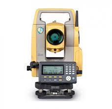
Figure 1 – Topcon ES-105 Electronic Total Station Machine
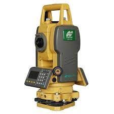
Figure 2 – Topcon GTS-102N Electronic Total Station Machine
(2) Leveling instrument used to measure elevation differences and distances with high accuracy, commonly used in field investigation and surveying.
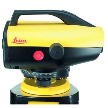
Figure 3 – Leica Sprinter 100M Digital Level Instrument
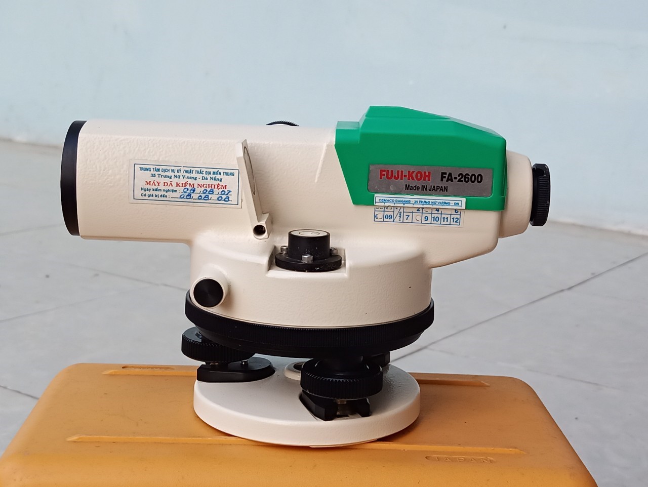
Figure 4 – Fuji–KOH FA-2600 Level Instrument
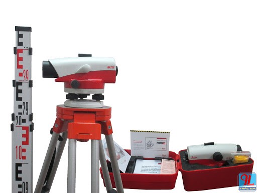 (3) Theodolite used to measure horizontal and vertical angles in space with accuracy up to 1 second (angle).
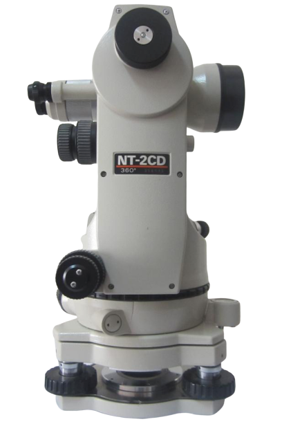
Figure 6 – Nikon NT-2CD Optical Mechanical Theodolite
(4) The dual-frequency GPS Topcon Hiper V satellite positioning system is capable of receiving satellite signals from multiple systems such as GPS, GLONASS, and QZSS. The GPS satellite positioning system is used to accurately determine positions, longitude, and latitude within a specified area.
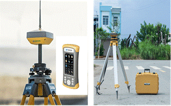
Figure 7 – Topcon Hiper VR Dual-Frequency GPS Satellite Positioning System
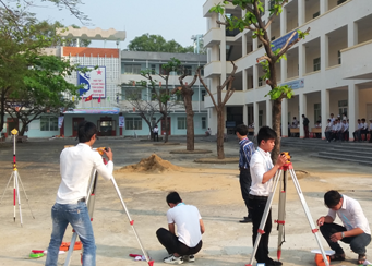
Figure 8 – Students using surveying equipment systems while participating in the “Treasure Hunt” competition
- Announcement on the Organization of Joint Training and Professional Development Programs in 2022
- Admission Announcement 2021 for Distance Learning and Guided Self-Study Programs
- Assignment of duties for members of the Executive Committee of the Trade Union of Central Transport College No. 5, term 2017–2022 (updated)
- Central Transport College No. 5 accompanies disadvantaged students during the COVID-19 pandemic
- Recruitment notice for positions at THACO Chu Lai